The
most critical element in meeting the objectives of a saturation field
monitoring
effort is the successful determination of actual aerial
source/receptor patterns
in the region of concern. Our key personnel
have over 20 years of applied
experience in measuring such relationships
in a field operations environment.
This experience involved the real-time
mapping of transport and dispersion
patterns by measuring the downwind
concentrations of emissions around a known
source.
Plume mapping projects
that our key people have managed and participated in
include hundreds of
tracer tests in urban and rural environments, as well
as, both ground and
airborne boundary layer pollution profiling projects utilizing
tracers
of opportunity.
The
Team's experience dates back almost three
decades to major projects mandated
by federal, state, and local
districts to determine dispersion patterns around
existing and proposed emission sources. The studies have ranged from multiple
power plant, area source, line source and dispersion studies in California, Colorado,
Nevada, Indiana, Illinois, Tennessee, Ohio, Missouri, South Carolina, Virginia
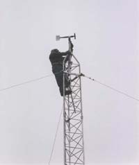
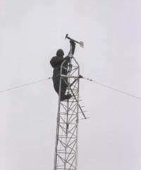
and Washington DC. All these studies included making ground based measurements
with up to 125 samplers to map the plume transport and dispersion. In addition,
many smaller scale source/receptor reconciliation programs to quantify emissions
from mining and material handling operations, vehicle emissions in tunnels, and
urban source emission patterns have been conducted by our key personnel. Clients
for whom the developed methodologies and technologies have been deployed include
Southern California Edison, Ohio Edison, Savannah River Laboratory, Consolidated
Edison, Pacific Gas and Electric, Exxon, Texaco, the California Air Resources
Board, various State Air Pollution Control Districts, and many others.
Some of our recent projects include:
Satellite
Site Operations for the California Regional PM10/PM2.5 Air Quality Study (CRPAQS)
Las Vegas Valley CO Saturation Study